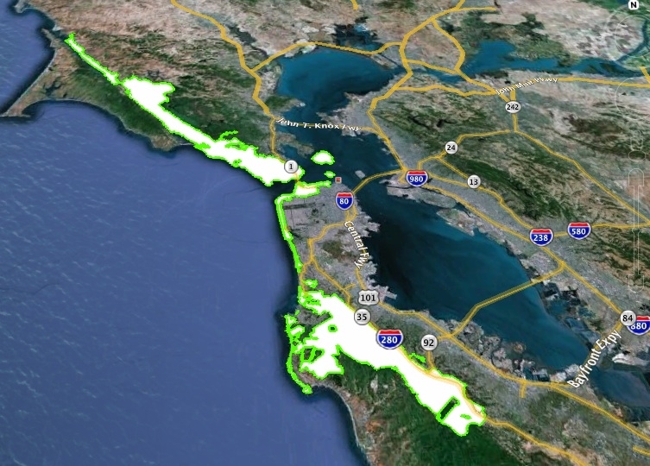
Legislative Boundary Map
The GGNP’s legislative boundary is much larger than the boundary familiar to most park visitors, because the GGNP has established a wide variety of partnerships with adjacent landowners in order to promote good stewardship. The map below should help you visualize where you may explore the park and count any sightings you may see on that exploration towards your GGNP Endangered Species Big Year.
You may also download a Google Earth .kml file here. You will need to download the free Google Earth application to use this file.
Leave a Reply
Want to join the discussion?Feel free to contribute!